The “Living Wild in South America” expeditions love landscape photography .
We have been working ‘in the field’ for over a year, in Argentina,Chile and Peru.
We have carried our equipment through humid forests, along gale blown cliffs and across hot deserts, but the most inspiring area for landscape photography has been the high Andes.
All these images, except the last, were taken at between 11,000 and 14,000 ft. At such heights where the air is thin, breathing is sometimes difficult. This means that you have to use a tripod as your breathing is so laboured, it causes camera shake. The lack of oxygen means that you have to go slowly, there is no hurrying at that altitude.
The air is usually crystal clear, but the weather is fickle and storms are common.
An inspiring place for a photographer but a really tough and challenging environment.
These six images will trace an imaginary journey from the Argentinian Chaco, over the great Andes mountains and down to the Pacific coast of Chile. All were taken with a Canon D6 camera and 18-55mm lens, always on a tripod and sometimes using a polarizing filter . The images have been developed in Lightroom with hardly any alteration except for the use of black and white sliders and cropping.
Travelling from Argentina, the foothills rise gradually, winding roads, some only tracks, twist and double back on themselves. Tall cacti are scattered across the thorny scrub and rock, dried up river beds lie sullen, like a serpent waiting to be woken.
The next time you look, the vegetation is much sparser, the cacti have gone and the land is flatter, this is the Puna, the historic and cultural home of the Andean people.
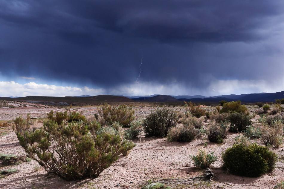
As we set up camp the sky turned ominous, thunderous rumbles echoing through the hills. Storms encircled us and lightning flashed from all directions. That night we got very wet!

Higher still and you reach the Altiplano where there is almost no vegetation. This is a dry, arid land, sculptured by the wind. Two days prior it had snowed and small scatterings of snow were still visible.
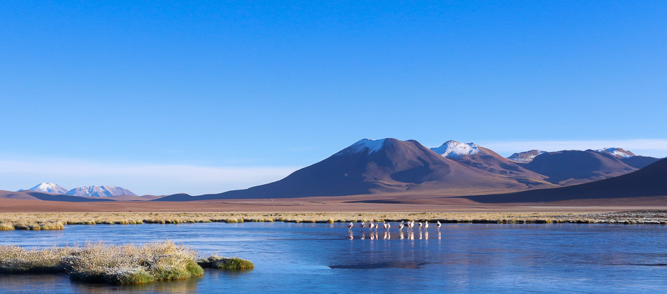
We cross over a high Andean pass into Chile. The Andes are one of the most volcanic parts of the planet. We camped close to this spot and early in the morning found a small group of Chilean Flamingos unable to move, as their feet were frozen into thin ice on the lake.
After several hours in my photographic hide, thawing out my own fingers took some time too!
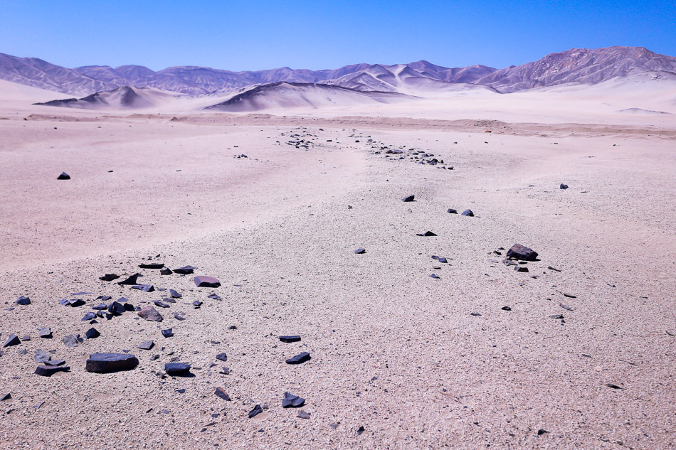
Gradually descending downwards from the Chilean Puna we enter the Atacama desert. At 600 miles long and up to 200 miles wide, the Atacama is the driest place on earth and a dangerous place for the unwary. It is a strange place, which we found difficult to photograph to our satisfaction.
See what I mean? Much of the Atacama is like this, flat, barren, devoid of anything. One afternoon I decided that was exactly what I should photograph, so I walked off and left Paula staring into the distance. This is now one of our favourite photographs, we call it ‘Lost in a landscape’.
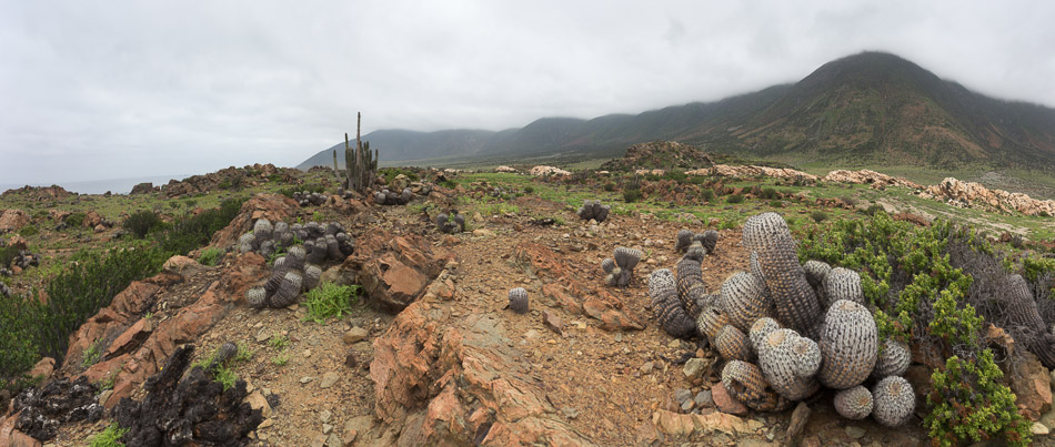
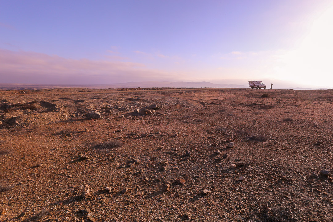
Finally we reached the Pacific coast of Chile, where the Atacama desert meets the Pacific Ocean. This coastal desert is a narrow strip of land which receives mist off the Pacific. This unique fog is called the Camanchaca and provides just enough moisture to sustain a sparse but cactus rich vegetation.